A few weeks back I wrote a blog post on an 1834 entire from Calcutta taking the curricle from Morpeth to Edinburgh. In it, I discuss how one needs to know the distances between the various towns the letter passed through in order to figure out the inland rate markings in Great Britain. Further, I mentioned that one could find the mileages in Alan Robertson’s 1961 book Great Britain: Post Roads, Post Towns, and Postal Rates 1635 to 1839 (Figure 1) (and reproduced in Colin Tabeart’s Admiralty Mediterranean Steam Packets 1830 to 1857).
This post is about Robertson’s Post Roads, its contents, and the bibliography of the original and the reprint.

Post Roads is not as famous as Robertson’s magnificent A History of the Ship Letters of the British Isles, a book by which he is most readily identified. Nevertheless, Post Roads is as relevant today as it was 60 years back – chiefly for its distance measurements and its road maps.
Robertson’s Post Roads
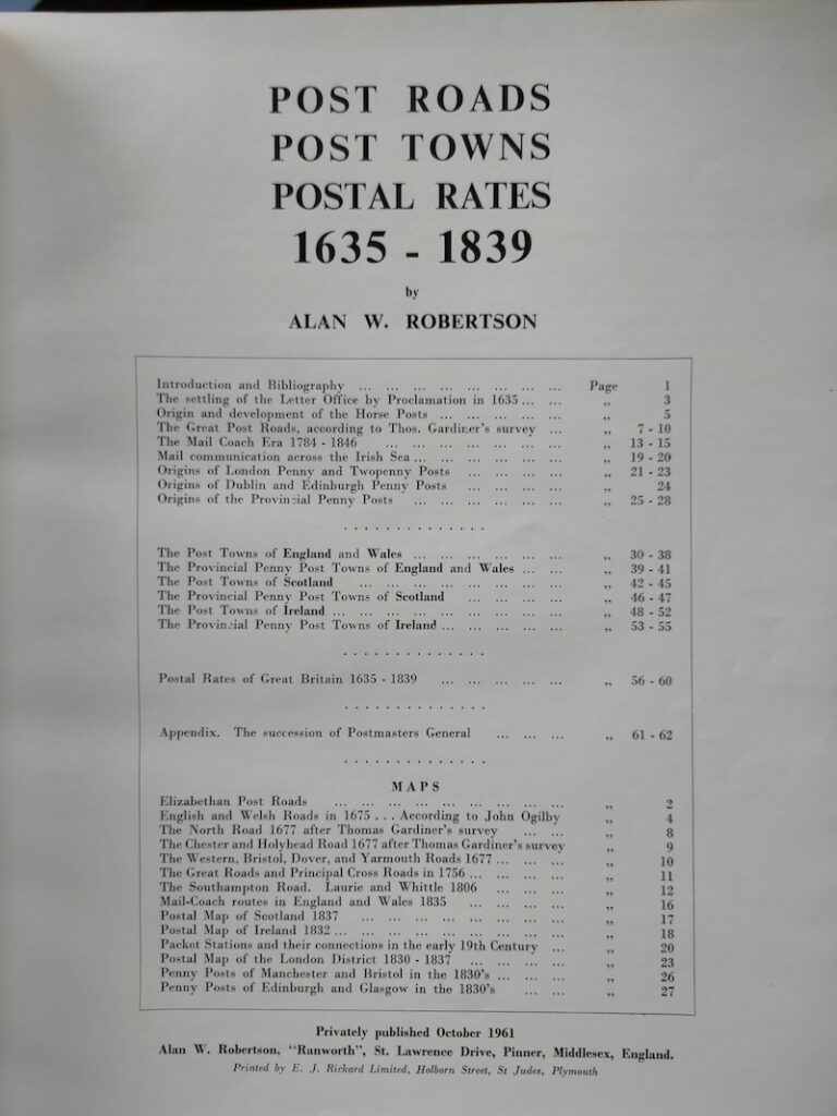
Robertson’s Post Roads, as the title suggests, covers its subject in three parts (Figure 2).
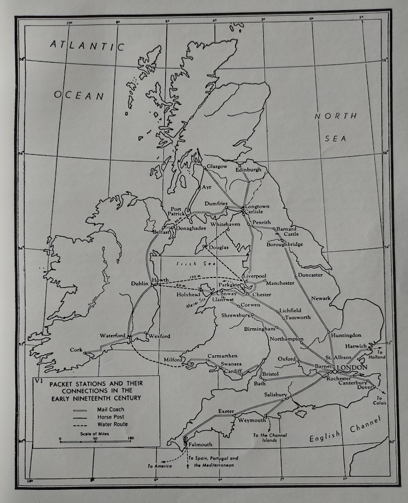
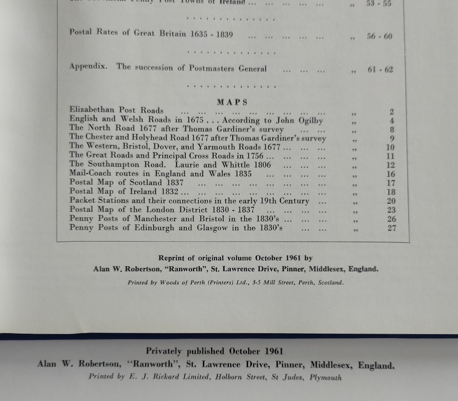
The first part introduces the reader to the postal roads and routes over which letters travelled starting from the 31 July 1635 proclamation of King Charles I which allowed the post office to carry private correspondence. Horse posts, mail coaches, and packet routes to Ireland are also covered as is the Penny and Twopenny posts of various cities and towns. The roads and routes are well illustrated through 14 postal maps (Figure 3); in fact, all maps in this book are contained in this part. That some of these maps are still referred to, indeed reprinted in recent publications, is a testament to their usefulness.
The second part contains the measurement of distances in England, Scotland, and Ireland from/to their respective major towns; about 2,000 towns and 8,000 mileage quotations in all (Figure 4). Before the advent of weight-based postage (from December 1839 in GB for instance), inland postal rates across the world were usually distance based; hence one needs the mileage numbers in order to figure out rate markings on covers.

Robertson borrowed these distance measures from the 1802 second edition of John Cary’s “delineation of the Great Roads, both direct and cross, throughout England and Wales; with many of the principal roads in Scotland” and were made “by command of His Majesty’s Postmaster General for official purposes” (Figure 5). Cary continued to improve upon his survey until his 11th and last edition published in 1828. While Robertson says that the margin of difference between the 1802 and later measurements is usually small and immaterial, postal history collectors may do well to check the later editions of Cary in case they are unable to reconcile the rates on their covers.

The third part is the shortest one and tabulates inland postage rates of Great Britain between 1635 and 1839. Knowledge about rates was rudimentary in Robertson’s times. Though he took the effort, much has been researched and written on it in the last three decades. One would typically not pick up this book for rates alone.
Post Roads – Original and Reprint
The bibliography of Post Roads (original) is given below:
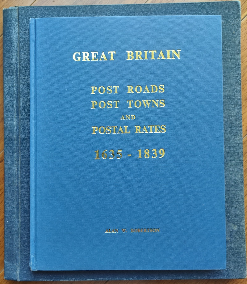
Robertson, Alan W. Great Britain: Post Roads Post Towns and Postal Rates. Pinner, Middlesex: The Author, 1961.
(2) + 62 pp + (1) p, printed on one side only. 286 x 249 mm. Hard Bound in Dark Blue Cloth with gilt lettering on front cover. DJ. Price 32/6 (32 shillings 6 pence) on DJ front panel.
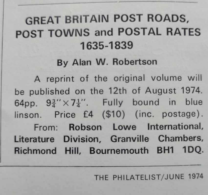
The original must have been published in limited quantity (and is scarce today, more so with its dust jacket intact). So, in August 1974, Robson Lowe made a reprint (presumably with Robertson’s consent) and priced it at £4 or US $10. The reprint does not mention the date of publication (Figure 6) and this needs to be confirmed from contemporary publications (Figure 7).
The main difference between the two is that, while the original is in large format, the reprint is smaller and hence handier (this may have inspired James Bendon who published the reprint edition of Ship Letters in 1993 by reproducing the original work at 80% size thus reducing it to two volumes; again, Bendon’s reprint is easier to work with).
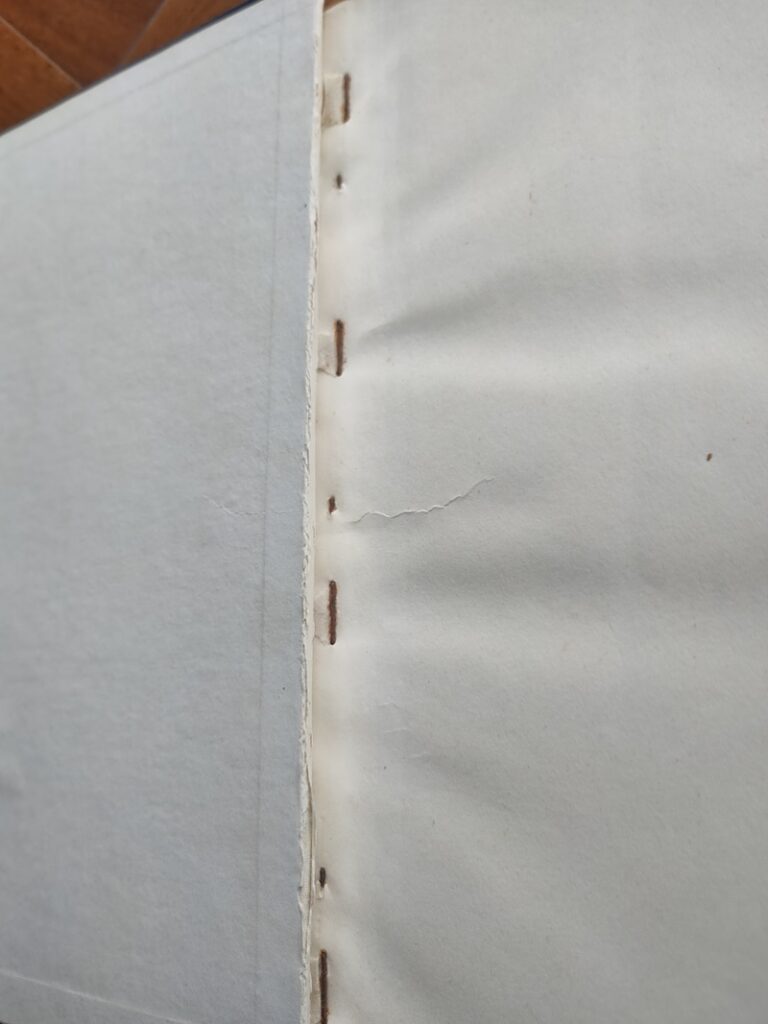
Further, the original comes with a dust jacket (which, given its large size, is more prone to wears and tears than usual) while the reprint does not. Finally, the original is staple bound (Figure 8) with hard boards covered in coarse cloth while the reprint is sew bound with hard boards covered in fine cloth.
For the record, I am giving the measurements of the original and the reprint (Figure 9)
- Original: 286 x 249 mm (outer boards); 281 x 245 mm (inner pages)
- Reprint: 253 x 194 mm (outer boards); 246 x 189 mm (inner pages)
It is interesting that the pages of the original are pretty much the same as Robertson’s Ship Letters – both in size and quality. The latter, being in the works since 1955, was still being added to when Post Roads was published and Robertson must have preferred the same kind of pages for his latest book.
Alan W. Robertson
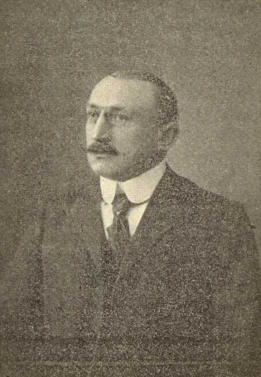
Alan William Robertson MBE (1910-1978) (Figure 10) was a noted ornithologist. He was awarded the MBE (Member of the Order of the British Empire) for his distinguished service in the Royal Air Force during World War II.

Robertson was philatelically active from an early age. He used his vast knowledge and collection to write that monumental and most useful postal history work – A History of the Ship Letters of the British Isles (An Encyclopaedia of Maritime Postal History). Published in parts over almost ten years (1955-1964) and occupying three volumes, this large-sized aesthetically pleasing work is unparalleled for its ground breaking research into the maritime history of Great Britain and retains its relevance into this day.
Robertson also wrote The Ship Letter Stamps of London (1951), The Ship Letter Stamps of Liverpool (1953), The Ship Letter Stamps of Hampshire (1955), and The Maritime Postal History of London 1766-1960 (1960) amongst others. Apart from books, he penned many articles in journals, such as the Postal History Journal, all the way from the 1940s into the 1970s.
He was President of both the Postal History Society and the Society of Postal Historians and a council member of the British Philatelic Association. In 1961, he was invited to sign the Roll of Distinguished Philatelists.
References
- Butler, A. R. The History of The Roll of Distinguished Philatelists. London: The British Philatelic Federation Limited, 1990
- Who Was Who in Philately. ABPS.org.uk. https://www.abps.org.uk/who-was-who-in-philately (accessed 14 January 2022)